Obstacle warning system
Don’t be afraid of cables.
The FLARM Obstacle Warning System alerts pilots of fixed obstacles such as powerlines, cable cars, and antenna towers that could pose a danger to aircraft. Obstacle databases can be installed in all major FLARM devices, including OEM products. To enable it, a database file for the relevant region with a valid license is installed in the device.
Databases are available for many regions such as the Alps, Germany, Switzerland, Austria, and Northern Italy. They are updated typically once per year. New regions are continually being added when there is demand. Databases can be purchased on the FLARM website. Shorter update intervals (e.g. AIRAC) are available on request.
The collision computer uses a spatial and temporal prediction algorithm for the aircraft trajectory to detect conflicts with obstacles in real-time. If there is a conflict, a visual and/or aural warning is annunciated, based on the connected display. Turning is included in the prediction to not produce false warnings when e.g. circling near a powerline. Heuristics based on the aircraft type and other parameters are applied to further refine the accuracy of the algorithm.
Product highlights
-
4D warning algorithms for high sensitivity, low nuisance alerts
-
Runs in real-time on most FLARM devices
-
Each database combines multiple sources for maximum quality
-
Data optimization using ASTER and SRTM Digital Elevation Models (DEM)
-
Manual data curating for uncompromised reliability
-
Annual updates; shorter update cycles available on request
Source Diversity
Having an accurate, high-quality obstacle dataset is extremely important for reliable warnings. Errors in the dataset may lead to nuisance alarms that quickly render the system difficult to use or even detrimental to safety.
While many organizations maintain and offer datasets, the scope, volume, accuracy, and quality differ tremendously. Some sources focus on aviation (WeGOM, AIP), while others on general use by a broad public (OSM). Fragmentation is often a problem, e.g. in Germany where the 16 states publish their own sets in differing formats and fidelity. Datasets for mapping, on the other hand, are very rich and cover large areas, but lack important details for aviation use.
Data Modeling
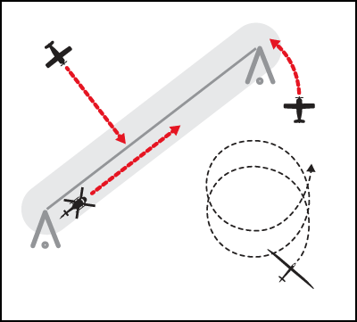
There are two basic types of obstacles: towers and cables. Towers are modeled as a vertical cylinder. This type is used for antennas, masts, and cranes. Cables are defined by a sequence of towers connected by 3D paths, forming a chain of individual segments. Each segment is extended by a prismatic protection volume.


Obstacle types: tower (left) and cable (right)
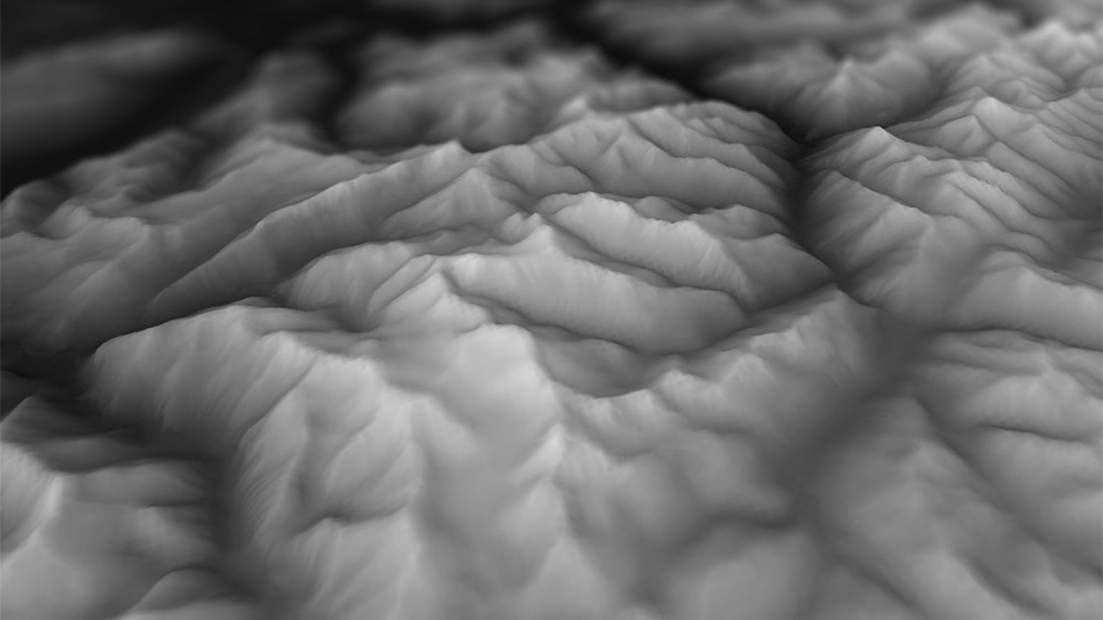
To create a database for a given region, the best sources are first selected. The data is then cleaned by removing discrepancies and redundant objects. A digital elevation model (DEM) based on SRTM and ASTER data is applied to validate and augment the data. Some sources do not contain elevation information, which is then added in this step. In addition, many sources contain only start- and endpoints of cables but not the masts. With the DEM, we can correct for e.g. cables running through mountain tops.

Digital Elevation Model (DEM) is used for data modelling
Finally, the source datasets are merged and duplicates removed. The remaining data is subsequently optimized and packaged in a file format that allows computing the collision risk in flight in real-time. The data structure used for this is called quadtree. It works by splitting the space up repeatedly into ever smaller quadrants until the number of objects in a quadrant is low enough. This way, a very large number of objects can be squeezed into a database while keeping the operation of finding nearby objects very fast and deterministic.
Precise warnings
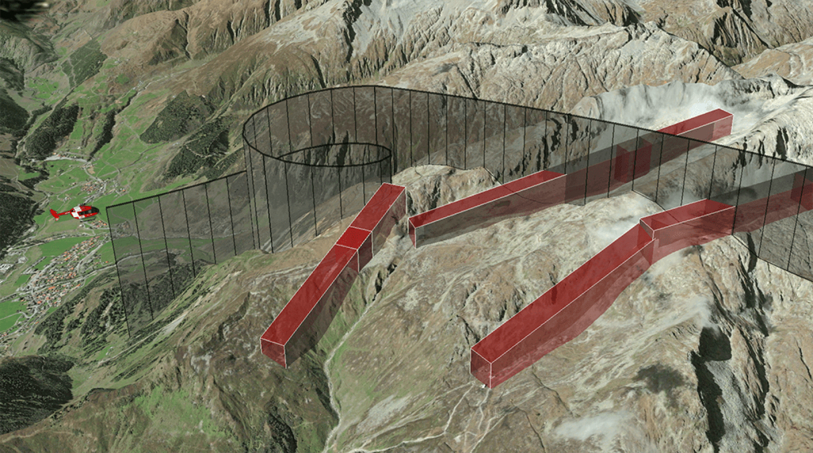
Less is sometimes more — as a pilot, you only want the relevant warnings, everything else is a nuisance. The algorithms take this into account by predicting where the aircraft is going. Based on GPS position and speed measurements, and considering the configured aircraft type, a predicted 4D trajectory is computed.
This includes accurate predictions of turns/circling and climbs/descents. Based on the dynamic relative position and velocity vector, a context-sensitive collision warning is issued.

Context-based collision warning
To account for modeling and measurement errors, every object is wrapped in a safety buffer. A collision warning is issued if the trajectory is predicted to enter the safety buffer. The warning intensifies as the predicted point of collision gets closer in time.

Regions
The following regions are available for purchase with a 1-year license. All regions are also available with more frequent updates (e.g. AIRAC) on request.
-
Switzerland
WeGOM, Cantonal GIS sources (Uri, Ticino, Grisons)
-
GBAIP ENR 5.4, OSM
-
GermanAIP ENR 5.4, OSM
-
Italy
AIP ENR 5.4, OSM, South Tyrol GIS data
-
FranceAIP ENR 5.4, OSM
-
Austria
Austro Control, Federal states GIS sources (Vorarlberg, Tyrol)
-
Slovenia
Slovinian eTOD, OSM
-
Norway
Norwegian Aeronautical Obstacle Register, OSM
-
Alps
All the sources mentioned above are used